
Priya Chandrasekar
Neighbourhood by neighbourhood, on foot
Based in Boston, United States.
Boston neighbourhoods writer mapping the city on foot, reading each area through its daily rhythms, not its Freedom Trail plaques.
Latest stories

South End, Boston: Brownstones, Garden Squares and the City’s Best Tables
A walk through Boston’s South End, where Victorian rowhouses, garden squares, galleries and a dense restaurant scene make the neighbourhood feel lived-in, not staged.
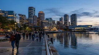
Seaport District, Boston: Glass Towers, Harbour Patios and a New Waterfront Rhythm
A walk through Boston’s newest square mile, where the harbour is always nearby, the patios fill at five, and the old warehouses in Fort Point still hold the neighbourhood’s best texture.

North End, Boston: cannoli, church bells and the city’s oldest streets
Boston’s Little Italy is a square mile of red-sauce rooms, Revolutionary landmarks and narrow lanes that reward walking, snacking and lingering.

Fenway-Kenmore, Boston: Ballpark Noise, Museum Quiet
From the Green Monster to the Gardner courtyard, Fenway-Kenmore is Boston at two volumes: loud around the park, hushed by the Fens.

East Boston, Boston: the peninsula that eats, looks out, and keeps moving
Across one Blue Line stop and a harbour’s width from downtown, East Boston folds airport grit, immigrant kitchens, and the city’s best free skyline view into one restless peninsula.

Downtown Crossing & Financial District, Boston: where shopping, statecraft and after-dark drinks overlap
Boston’s most transactional square mile is also one of its most layered: a pedestrian retail spine, a Freedom Trail corridor and, increasingly, a place to linger after office hours.

Charlestown, Boston: where the Revolution still walks the hill
A steep, brick-built peninsula of ferries, taverns and warship masts, Charlestown feels less like a district than a small city with its own memory.
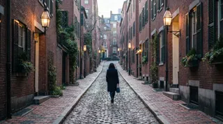
Beacon Hill, Boston: brick, lamps and the slow life of Charles Street
A walkable pocket of Boston where Federal rowhouses, Black history, antique shops and low-lit dining still shape the day-to-day rhythm.
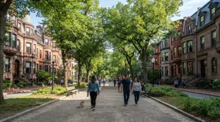
Back Bay, Boston: brownstones, bookstores and rooftop views
A walkable, polished Boston neighbourhood of Victorian rows, Copley Square landmarks, Newbury Street shopping and rooftop dining.
Every story is signed and dated, and follows our editorial standards.